Hi! I’m Douglas Baltes. I studied sea life at the University of Tasmania. I love nature, like the ocean and forests. I’ve hiked in Kauai for years. This guide is about Puu Ka Pele Forest Reserve. It’s near Waimea Canyon. You’ll learn about lookouts, hikes, maps, and camping. I wrote this to be super easy to read. Let’s explore this amazing place together!
Why Go to Puu Ka Pele Forest Reserve?
Puu Ka Pele Forest Reserve is in Kauai. It’s next to Waimea Canyon, called the “Grand Canyon of the Pacific.” It’s a beautiful place. You see red cliffs, big waterfalls, and green trees. There are birds like the Nene goose, which is rare. The reserve is part of Waimea Canyon State Park. It’s close to Koke’e State Park too.
What Is Puu Ka Pele Forest Reserve?
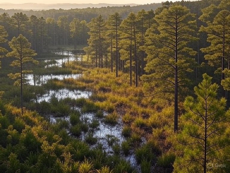
Puu Ka Pele is a special area in Kauai. It protects nature near Waimea Canyon. The land has steep cliffs and deep valleys. The Waimea River flows through it. The water looks red because of the canyon’s dirt. It’s pretty from above.
The reserve has plants and animals you won’t see everywhere. You might see kukui trees or hear birds chirping. Long ago, Hawaiian people used trails here to travel between villages. Today, it’s a place to hike, camp, and enjoy nature.
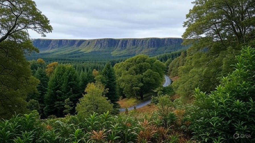
How It Connects to Waimea Canyon
Waimea Canyon is huge. It’s 10 miles long and over 3,500 feet deep. Puu Ka Pele is on the west side of the canyon. It has trails and lookouts with great views. It’s quieter than other parts, so it’s perfect for a calm visit.
Lookouts Near Puu Ka Pele
Lookouts are places to stop and see the canyon. You can drive to them on Highway 550. They’re easy to reach. Here are the best ones near Puu Ka Pele.
Puu Ka Pele Lookout
This lookout is near mile marker 13 on Highway 550. It’s a small spot. You park on the side of the road. The view shows Waimea Canyon through a narrow gap. You see Waipo’o Falls, a tall 800-foot waterfall. It’s prettiest in winter when water flows a lot. In summer, it can be dry.
Across the road, there’s a picnic area. It has restrooms and water. It’s a nice place to sit. Be careful near the edge. There are no fences, and it’s a big drop.
Puu Hinahina Lookout
This lookout is past Puu Ka Pele, near mile markers 13 and 14. It has a big parking lot. There are two places to stand and look. One is good for wheelchairs. You see a curve in the canyon. The view is wide and clear. It’s busier than Puu Ka Pele but worth it.
Waimea Canyon Lookout
This is the main lookout. It’s past mile marker 10. It has a big parking lot. You see the whole canyon and Waipo’o Falls from far away. The red cliffs and green valleys are beautiful. It’s great for pictures.
Tips for Lookouts
- Go Early: Mornings are less crowded. The views are clearer too.
- Bring a Camera: A zoom lens is good for faraway waterfalls.
- Check Weather: Rain makes roads slippery. Look at the forecast.
- Stay Safe: Stand behind any barriers. Watch your step near cliffs.
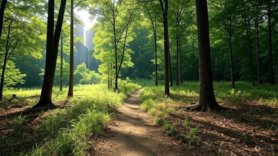
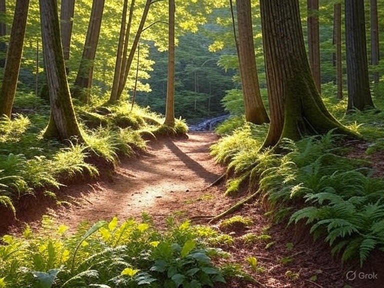
Hiking Trails Near Puu Ka Pele
Hiking is a fun way to see the reserve. There are easy and hard trails. I’ll tell you about the best ones.
Iliau Nature Loop
This trail is super easy. It’s only 0.3 miles long. It starts near Highway 550, between mile markers 8 and 9. You see signs about rare plants, like the iliau. It’s a special Kauai plant. The trail shows Waimea Canyon views. It’s good for kids and takes about 15 minutes.
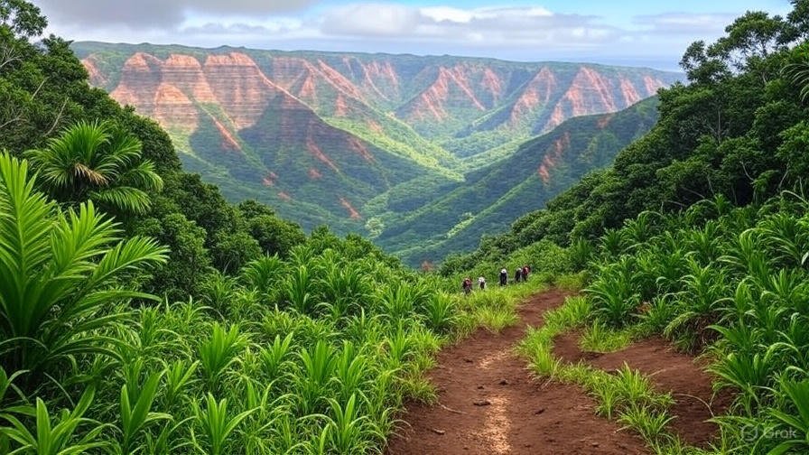
Kukui Trail
This trail is hard. It’s 4.6 miles round-trip. It goes down 2,250 feet to the Waimea River. The trail starts at the Iliau Nature Loop. It’s steep and can be muddy, especially on Red Hill. You walk through kukui trees and see canyon views. At the bottom, you reach Wiliwili Camp. It has a shelter and a toilet.
This hike is tough. You need strong shoes and lots of water. It takes 3 to 4 hours. The climb back up is hard work.
Koaie Canyon Trail
This trail starts where the Kukui Trail ends. It’s 6 miles round-trip. It follows the Koaie Stream. You see waterfalls and swimming holes. Don’t swim after big rain. Flash floods can happen. The trail can be hard to follow because plants grow over it. It ends at Lonomea Camp, about 2 miles up.
This hike is for strong hikers. It takes 4 to 5 hours. You need a permit to camp.
Waimea Canyon Trail
This trail is very long. It’s 11.5 miles one way. It goes along the Waimea River from the Kukui Trail to Waimea town. You need a permit to enter. You cross the river many times. Watch for high water. The views are amazing, but it’s tough. It takes 6 to 8 hours. Most people get a ride back.
Pihea Trail
This trail is in Koke’e State Park but close to the reserve. It starts at Puu O Kila Lookout, near mile marker 23. It’s 3.8 miles round-trip. You see the Na Pali Coast and Kalalau Valley. It’s a ridge trail with steep drops. Be careful. It takes 2 to 3 hours.
Hiking Tips
- Wear Good Shoes: Trails are muddy and rocky. Waterproof shoes help.
- Bring Water: Most trails have no water. Treat river water before drinking.
- Get Permits: Some trails need permits. Check Hawaii’s camping website.
- Start Early: It’s cooler in the morning. You’ll have more time.
- Watch Weather: Rain makes trails slippery. Rivers can flood.
Camping in Puu Ka Pele
Camping is a great way to stay in nature. The reserve has campsites along trails. You need a permit for all camping.
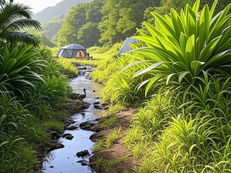
Wiliwili Camp
This camp is at the bottom of the Kukui Trail. It has a rain shelter, a picnic table, and a toilet. It’s near the Waimea River. It’s a quiet spot for a night. You need a permit from the Hawaii Division of Forestry and Wildlife.
Hipalau and Lonomea Camps
These camps are on the Koaie Canyon Trail. Hipalau is less than a mile from the Kukui Trail’s end. Lonomea is about 2 miles up. Both have swimming holes nearby. Check if the water is safe. Each camp has a shelter and toilet. You need permits.
Camping Tips
- Get Permits Early: They sell out fast in summer. Book at camping.ehawaii.gov.
- Pack Light: You carry everything down steep trails.
- Treat Water: Filter or boil river water.
- Avoid Rainy Times: Winter and spring have more rain. Floods are risky.
- Clean Up: Take all trash with you to keep the reserve nice.
Maps and How to Find Your Way
Maps help you stay safe. Here’s how to get them and use them.
Where to Get Maps
- Hawaii Division of Forestry and Wildlife: Their website has maps for Waimea Canyon and Koke’e State Park. They show trails like Kukui and Koaie.
- The Ultimate Kauai Guidebook: This book has good trail maps and tips.
- AllTrails App: This app has maps for Kukui, Koaie, and Pihea Trails. Save them for offline use.
- Visitor Centers: Get paper maps at Waimea Canyon or Koke’e State Park.
Navigation Tips
- Save Maps Offline: Phone service is bad in the canyon.
- Bring a Compass: GPS can fail in deep valleys.
- Mark Trail Starts: Note where you begin. Trails can be hard to find.
- Use Mile Markers: Highway 550 signs help find lookouts and trails.
Planning Your Trip
Good planning makes your visit better. Here’s what you need to know.
How to Get There
Drive from Waimea town on Highway 550. It’s about 9 miles to the Kukui Trailhead. From Kekaha, take Koke’e Road, then turn left on Highway 550 for 2 miles. The road is paved but twisty. Get gas in Waimea. There are no gas stations in the park.
Best Time to Go
The park is open all year. Summer (May to September) is dry but hot. Winter (October to April) has more rain. Waterfalls look better in winter. Mornings have clear views.
What to Bring
- Clothes: Wear layers. The canyon is hot, but lookouts are cooler.
- Sunscreen and Hat: The sun is strong on trails.
- Water and Snacks: Bring enough for long hikes.
- First Aid Kit: Cuts need care to avoid infection.
- Bug Spray: Mosquitoes live near rivers.
Safety Tips
- Check Weather: Rain can cause floods. Avoid river trails after rain.
- Stay on Trails: It’s easy to get lost in thick plants.
- Tell a Friend: Share your hiking plan with someone.
- Watch Animals: Don’t feed wildlife like the Nene goose.
Conclusion
Puu Ka Pele Forest Reserve is a wonderful place to visit in Kauai. You can see amazing views at lookouts like Puu Ka Pele and Waimea Canyon. Hiking trails like the Iliau Nature Loop and Kukui Trail let you explore nature. Camping at places like Wiliwili Camp is fun with a permit. Maps help you find your way safely. This guide gives you all the tips you need for a great trip. I, Douglas Baltes, love nature and want you to enjoy this special place. Plan your visit, stay safe, and have fun exploring!
Disclaimer: This guide about Puu Ka Pele Forest Reserve and Waimea Canyon is for information only. I, Douglas Baltes, share my knowledge to help you plan your trip. Always check weather, trail conditions, and permit rules with official sources like the Hawaii Division of Forestry and Wildlife before you go. Hiking and camping can be risky. Stay safe, follow park rules, and use your best judgment. I’m not responsible for any issues during your visit. Enjoy nature, but be careful!
Explore More:
Holman Lane Entrance: Your Quiet Path to Portland’s Forest Park
Inyo National Forest: Home to Tall Mountains, Old Trees, and Big Wild Places
Explore Jon J Duerr Forest Preserve: Hidden Waterfall, Old Memorials & Pretty Fox River Trails

Douglas Baltes is a writer who loves the ocean! He has worked for five years to learn about it. He writes fun stories about the Great Southern Reef in Australia, a big place with giant kelp forests under the water. Douglas has a degree in Marine Biology from the University of Tasmania, so he knows a lot about sea life! He works with nice groups to save the kelp forests. Douglas writes easy and exciting stories about them. He also leads happy projects to help the forests grow again. The Australian Marine Conservation Society loves his work!